
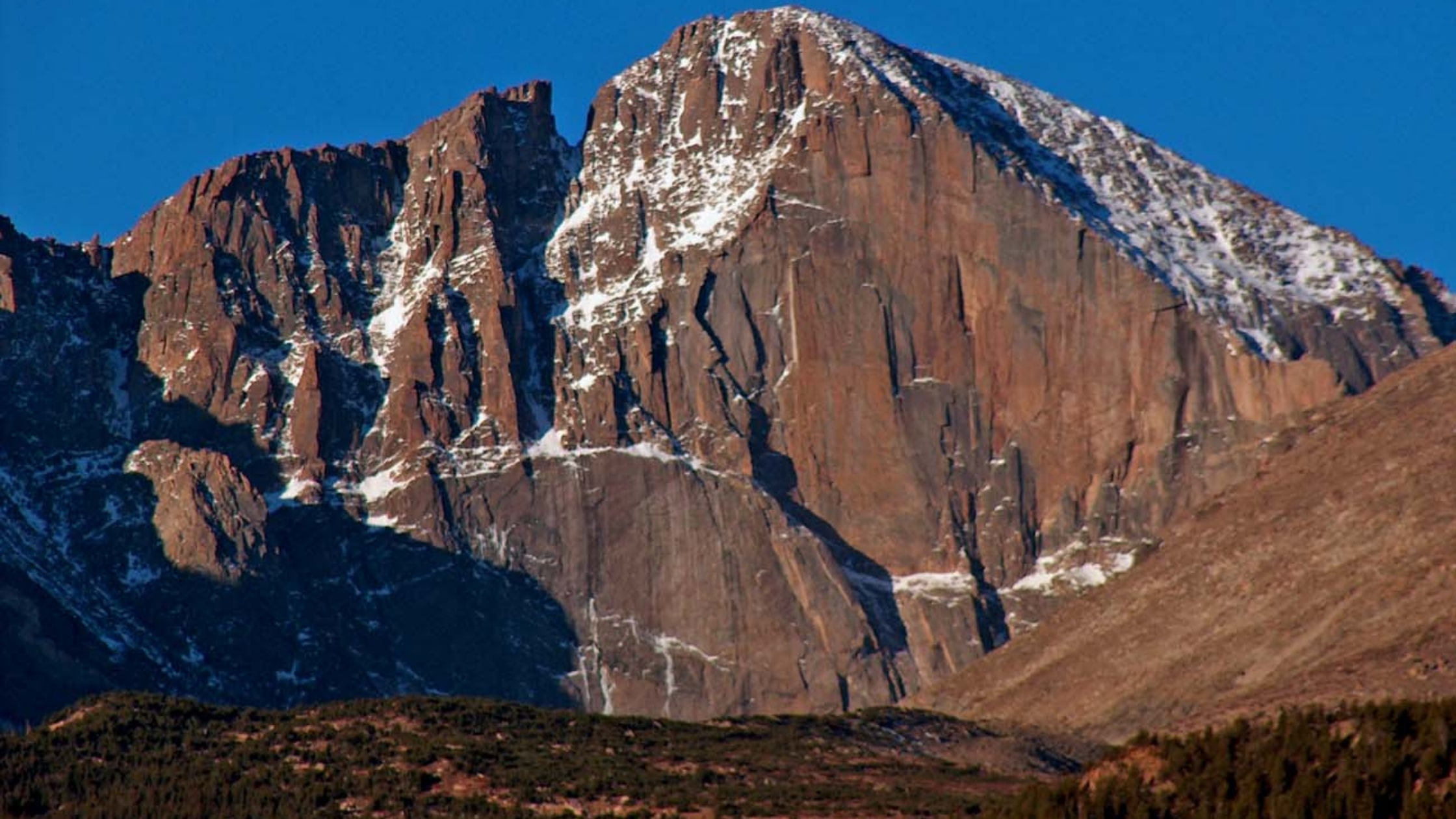
As one of the most prominent peaks in Colorado, Longs Peak stands at an elevation of 14,259 feet in the northern Front Range of the Rocky Mountains National Park Wilderness. Considered one of the most majestic peaks in the United States, it lies just nine miles from the town of Estes Park, Colorado.
Named after Stephen Harriman Long, the peak is the highest point in Boulder County, Colorado and the Rocky Mountains National Park. Along with the Mount Meeker, which has an elevation of 13,100 feet, both mountains are often referred to as Twin Peaks.
Today, Longs Peak remains one of fewer than 50 mountains in Colorado to have a glacier, Mills Glacier, located around 12,800 feet at the base of the Eastern face, right above Chasm Lake with a permanent snowfield referred to as The Dove, located north of Longs Peak.
A Brief History
The only fourteener in the Rocky Mountains National Park, the peak has been a destination for climbers for several decades. The easiest trail is not considered technical and was likely used by pre-Columbian indigenous people to collect Eagle feathers. The first recorded climb on Longs Peak was in 1868 in the surveying party of John Wesley Powell on the mountain’s south side. A few years later in 1871, Addie Adams became the first woman to scale the peak.
Climbing Longs Peak
Longs Peak trails include East Longs Peak Trail, the Long Peaks Trail, Clark’s Arrow, the Shelf Trail and the Keyhole Route. Some technical climbing is required to reach the summit of Longs Peak during the summer, which typically runs from mid-July to September. The Keyhole route remains closed during season months. Since dangerous ice and snowfall, the Keyhole is upgraded to a technical trail because climbers need to use specialized climbing equipment, like crampons and an ice axe at the minimum. In Colorado, the peak is considered one of the most difficult Class 3 fourteener scrambles.
The distance from the beginning of the trail to the summit spans 8.4 miles, with an elevation gain of 4,875 feet. Most hikers start climbing before dawn to reach the summit and return below the treeline before the risk of frequent afternoon thunderstorms. Boulder Field, which sits 6.4 miles into the hike, is the most difficult of the hike. After climbers scramble over the boulders, they finally reach Keyhole. The next quarter mile involves a scramble along narrow ledges, which have nearly sheer cliffs standing 1,000 feet or more just off the edge. The following portion of the hike includes climbs over 600 vertical feet called the Trough. Then, hikers finally reach the most exposed section of the trail, the Narrows. Beyond this area, the Notch demonstrates the start of the Homestretch, a steep climb to a large field and flat summit. Many hikers camp here overnight in the Boulder field with a permit, which makes for an easier two-day hike.
Longs Peak is an overall challenging climb. Sadly, 58 people have died climbing or hiking the peak. The National Park Services has estimated that, on average, two people die each year attempting to climb the mountain. Unexperienced mountaineers are encouraged to use a guide for the summit, mitigating the risk in engaging with the trial.
There are less-involved hikes on the peak for the many hikers who don’t wish to climb the summit. Peacock Pool and Chasm Lake are frequented hiking destinations that have well-maintained trails. Technical climbers, with a permit, may want to check out sites at the base of the East Face and at the rarely-visited Chasm View, the ridge between the east face of Longs Peak and Mount Lady Washington. For many experienced hikers, a rewarding hike is through the Boulder Field and the Keyhole. Other hikers may wish to camp on the lower portions of the mountain like Goblin’s Forest next to a stream at the very bottom. Another great spot to camp is on the mountain’s south side at Sand Beach Lake.
In addition to the standard Keyhole route, more common technical climbs on Longs Peak include, in order of popularity:
The North Face Cables Route: Following the Keyhole route to the Boulder Field, the North Face Cables ascends on the north side of the peak. It requires two pitches of low-5th class climbing. This mountain face is often downclimbed or rappelled by technical climber since it is one of the fastest ways to descend the peak.
Kieners Route: This traditional mountaineering climb involves heading up Lambs Slide (named after Reverend Elkanah Lamb who unintentionally slid down much of the route in 1871), which is icy later in the season, followed by an exposed traverse of the Broadway ledge, and then low-5th class climbing.
Climbers should always be aware that qualified instruction is needed for these routes, but they offer scenic challengers for those capable of climbing.